Jayton, Texas


Kent County’s
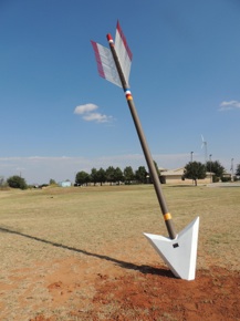
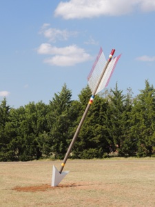
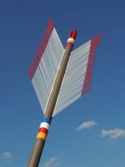
Trail Arrow is visible to travelers on U. S. 7o / Main Street through Jayton.

Jayton

An old Comanche-Kiowa trail through the area no doubt followed a route established by the great herds of bison that roamed the Southern Plains. The trail came to be known as the Comanche War Trail -- a route followed by the Comanche when they made raids into Mexico. A map drawn by R.J. “Red” Walker in 1972 is a re-creation of Kent County as it would have looked in the 1880s, based on Walker’s research. The Indian trail follows a north-south route that roughly bisects the county. The map is in the collecton of the Scurry County Museum, one county away.
Captain Randolph B. Marcy followed the same trail in his exploratory expedition through Texas in 1852.
In Jayton, the old First National Bank (now the Kent County State Bank) is a symbol of the town’s early prosperity, a gem in the context of regional architecture. Look for it one block off U. S. 70 on South Donaho Avenue.
In nearby Clairemont, 14 miles to the southwest, the old county jail stands intact from the time the little town was the countyseat. The two-story courthouse, damaged by fire, is now a one-story building, still picturesque.
History
&
Things To See
All photos by
Hanaba
Munn
Welch
©2013


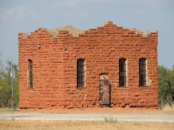
OLD KENT COUNTY JAIL
