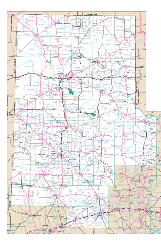
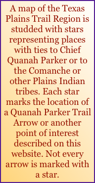
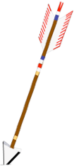
A map of the Texas Plains Trail Region is studded with stars representing places with ties to Chief Quanah Parker or to the Comanche or other Plains Indian tribes. Each star marks the location of a Quanah Parker Trail Arrow or another point of interest described on this website. Not every arrow is marked with a star.
Hardeman_County_1.html
Map © Texas Department of Transportation
Scurry_County_1.html
Crosby_County_1.html
Dickens_County_1.html
Motley_County_1.html
Armstrong_County_1.html
Hutchinson_County_1.html
Foard_County_1.html
Wheeler_County_1.html
Collingsworth_County_1.html
Gaines_County_1.html
Cottle_County_1.html
Look for the
ROADSIDE ARROWS!Arrow_List.html
Terry_County.html
Copper_Breaks_State_Park.html
Lipscomb_County.html
Howard_County.html
Garza_County_1.html
Borden_County.html
Knox_County.html
Dallam_County.html
Yoakum_County_2.html
Gaines_County_2.html
Mitchell_County.html
Dawson_County.html
Lynn_County_2.html
Lynn_County_1.html
Lipscomb_County.html
Randall_County,_Palo_Duro_Canyon.html
Lubbock_County.html
Oldham_County_1.html
Hall_County_2.html
Hall_County_1.html
Bailey_County.html
Parmer_County.html
Deaf_Smith_County.html
Hemphill_County.html
Briscoe_County.html
Briscoe_County.html
Briscoe_County.html
Hale_County_1.html
Hale_County_1.html


QUANAH  PARKER  TRAIL

Hockley_County.html
Cochran_County.html
Carson_County.html
Donley_County.html
Armstrong_County_2.html
Lamb_County.html
Sherman_County.html
Hartley_County.html
Kent_County.html
Floyd_County.html
Roberts_County.html
Potter_County.html
Swisher_County.html
Swisher_County.html
Yoakum_County_1.html
Lamb_County.html
Terry_County.html
Lynn_County_1.html
Hockley_County.html
Childress_County.html
Gray_County.html
Armstrong_County_3.html
Motley_County_2.html
Castro_County.html
Oldham_County_2.html
Gray_County.html
Hansford_County.html
King_County.html
Lynn_County_1.html
Moore_County.html
Hockley_County.html
Charles_Smith_1942-2018.html