QUANAH PARKER TRAIL


Denver City, Texas

Mackenzie Draw crosses Yoakum County just north of Denver City. For the Comanche and other native peoples, the draw was a trailway -- one of three across the area.
Strategic Trail Location


© 2011
H. HUMPHRIES
© 2011
H. HUMPHRIES
© 2011
H. HUMPHRIES
© 2011
TAI KREIDLER

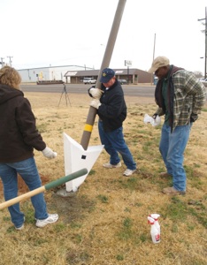
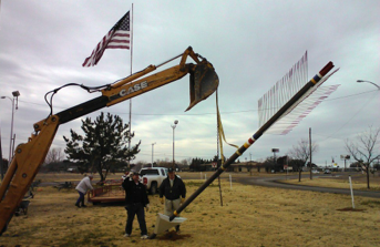
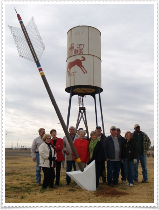
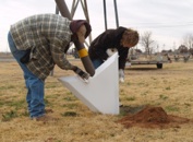
A Quanah Parker Trail arrow, installed December 14, 2011, marked Denver City as a place with historic ties to the Comanche and other native peoples who once hunted and lived in the region. In March 2015, Denver City removed and stored the arrow for eventual reinstallation at the site of a new museum.
The date of the Denver City arrow reinstallation will be announced. To the north, Plains, the county seat, has a Trail Arrow.
Meanwhile, a word from Holle Humphries, trail facilitator, about the significance of the Denver City area:

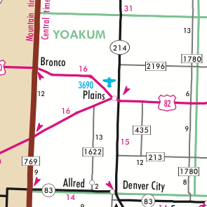


Plains
Denver City

© 2011
H. HUMPHRIES
Disappearing Arrow
The Comanches and Indians before them knew that the sand dunes that one can still see today called the Lea-Yoakum Sand Dunes and those visible around Denver City did not signify a desert. Instead, these dunes are remnants of an ancient river system that once flowed northwest to southeast through the area. Indians knew to dig beneath the surface of the sand dunes to find water. And so they frequented the sand dunes to hunt the plentiful game once there, and perform sacred rites during their encampments. Evidence of these visits to the area by Comanche, Kiowa, and prehistoric Indians before them was discovered in the 20th century by local ranchers and verified by archaeologists.